ANTIQUE FRAMED THOMAS KITCHEN – MAP OF SUSSEX
Circa 1763
Stock Number: 010955/215
Height: 24 ins / 60.96 cm
Width: 28 ins / 71.12 cm
Price: £475
THOMAS KITCHEN
An accurate Map of Sussex Drawn from the Best Surveys & Intelligences Divided into its hundreds…by Tho. Kitchin Geogr.
Circa 1763
Frame size: 24 x 28 inches / 61 x 71 cm
Printed for Thos. Kitchin, R. Sayer, J. Ryall, H. Overton, T. Bowles, J. Bowles, Messers. Bakewell and Parker. From the Royal English Atlas published C.1763. The first edition.
Inset view of Chichester Cathedral. Very decorative cartouche. Very much in the style of the larger, less rare English Atlas, with topographical and historical notes filling the area outside the county boundary. The descriptions have been condensed, but additions have been made. Good condition with repaired lower centre fold. The colouring is a mixture of mostly original and some later, finely executed. See Kingsley 43 (ii). There were numerous editions until 1828, the first edition is by far the rarest.

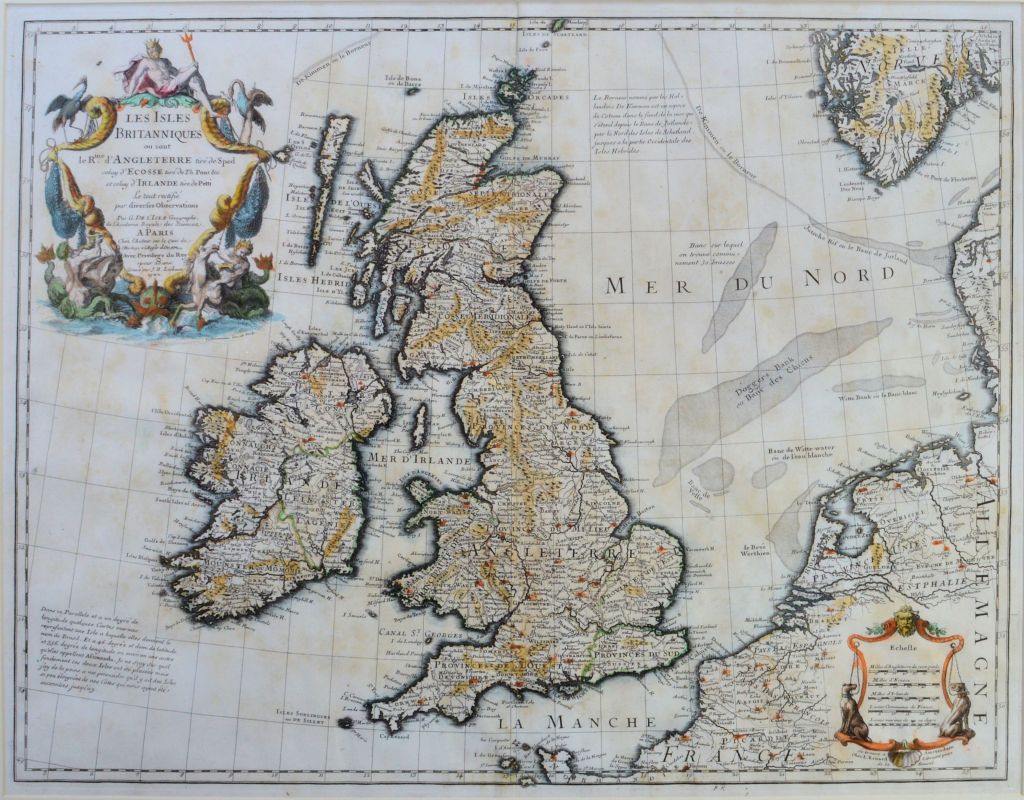 ANTIQUE FRAMED MAP-LES ISLES BRITANNIQUES ON SON LE RUE D ANGLETERRE